@djp3tros And here are two pre-crash tweets with more information:
https://t.co/WZgKRo51IA
https://t.co/0gbYLMrkRI
— Сергій Яковлєв (@sergeiyakovlev) July 23, 2014
It is very important to note that these tweets are done BEFORE the crash. It means they could not have been fabricated!
@djp3tros 2: “somebody wrote in the morning that it was standing on the intersection of b.Shakhtostroiteley and Ilchicha, …” (cont.)
— Сергій Яковлєв (@sergeiyakovlev) July 23, 2014
@djp3tros 2: “… in the direction of Makeevka. they were waiting, probably…”
— Сергій Яковлєв (@sergeiyakovlev) July 23, 2014
@djp3tros
Ilchicha = Illicha [typo]
b.Shakhtostroiteley = Shakhtobudivnykiv Blvd [“stroitel” in Russian = “budivnyk” in Ukrainian]
— Сергій Яковлєв (@sergeiyakovlev) July 23, 2014
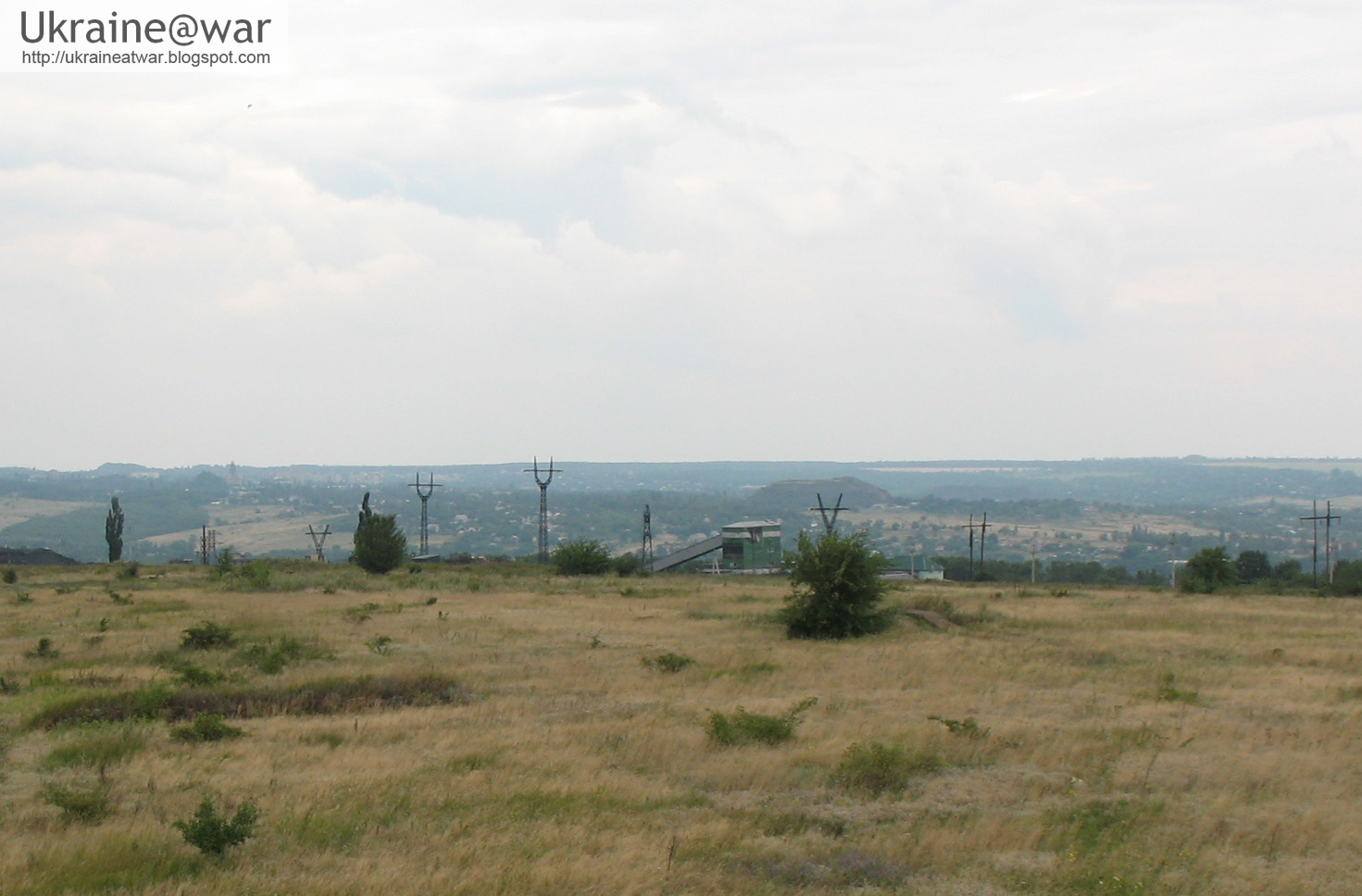
@djp3tros So the location is here: https://t.co/I13eeP6I8S
— Сергій Яковлєв (@sergeiyakovlev) July 23, 2014
@djp3tros Which proves that the #Buk really was in Donetsk that morning.
— Сергій Яковлєв (@sergeiyakovlev) July 23, 2014
@djp3tros Another interesting detail in that tweet is that “it was standing” and “they were waiting”.
— Сергій Яковлєв (@sergeiyakovlev) July 23, 2014
@djp3tros My understanding of that phrasing is that the #Buk was actually parked there for some time. Meaning there might be witnesses.
— Сергій Яковлєв (@sergeiyakovlev) July 23, 2014
Besides this non fabricated eye-witness report, we have a leaked phonecall from the driver to his commander.
@djp3tros There’s more to this. In the intercepted calls, Sanych tells Khmuryi where he should move the #Buk: http://t.co/QdEcOBGE1i, 2:58
— Сергій Яковлєв (@sergeiyakovlev) July 23, 2014
@djp3tros The SBU translation: “There, behind the ‘Motel’, outside Hornostaevka village”. That’s wrong transcription and wrong translation.
— Сергій Яковлєв (@sergeiyakovlev) July 23, 2014
@djp3tros Sanych says: “… за мотелем … не доезжая Горностаевской …”
— Сергій Яковлєв (@sergeiyakovlev) July 23, 2014
@djp3tros “за мотелем” is ambiguous; it could mean “past the motel” (after passing the motel) or “behind the motel” (hidden from street)
— Сергій Яковлєв (@sergeiyakovlev) July 23, 2014
@djp3tros “не доезжая Горностаевской” means “stopping before Hornostaevskaya”
— Сергій Яковлєв (@sergeiyakovlev) July 23, 2014
@djp3tros So the correct translation is: “past the motel [behind the motel], stopping before Hornostaevskaya”.
— Сергій Яковлєв (@sergeiyakovlev) July 23, 2014
@djp3tros Now, if you start from Shakhtobudivnykiv Blvd/Illicha Ave intersection and drive eastwards, there’s Hornostaivs'ka St right there!
— Сергій Яковлєв (@sergeiyakovlev) July 23, 2014
@djp3tros That means we should look for a motel along the Makiivs'ke Hwy.
— Сергій Яковлєв (@sergeiyakovlev) July 23, 2014
@djp3tros Found it! http://t.co/1M8ZORUlQ5 Makiivs'ke Hwy, 90
— Сергій Яковлєв (@sergeiyakovlev) July 23, 2014
@djp3tros Here’s the transcript in English: http://t.co/Kk5DIEhptS
— Сергій Яковлєв (@sergeiyakovlev) July 23, 2014
@djp3tros In the next call Khmuryi actually says: ‘behind the circle near Motel’.
— Сергій Яковлєв (@sergeiyakovlev) July 23, 2014
@djp3tros Finally found out what Motel is. It’s a big separatist checkpoint established on Jun 3 at the road circle http://t.co/kxxllQKOGI
— Сергій Яковлєв (@sergeiyakovlev) July 23, 2014
@djp3tros It was named after the bus station nearby (says the article).
— Сергій Яковлєв (@sergeiyakovlev) July 23, 2014
@djp3tros Here are two bus stops named “Motel” at the same location: http://t.co/mWlvxYshIX http://t.co/TsGhYrbho6
— Сергій Яковлєв (@sergeiyakovlev) July 23, 2014
@djp3tros Summary: #Buk was waiting for some time at Shakhtobudivnykiv/Illicha (tweet), then moved to separatist checkpoint Motel (call).
— Сергій Яковлєв (@sergeiyakovlev) July 23, 2014
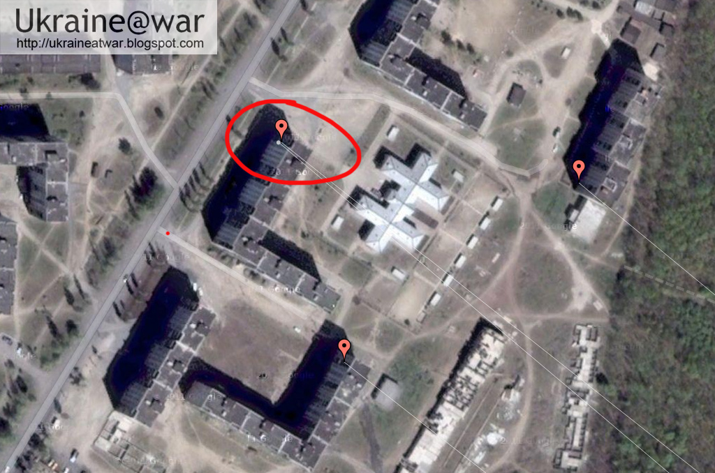
What Sergei probably did not know, but what I figured out in an earlier blog, is that Vostok batallion has it's residence in that area in an abandoned mine. It means 'motel' can also be a codename for 'the place where we stay'.In this map we can see all this information together:

The BUK is parked on a loader on the left side at the start of the route. The real motel is just at the corner. The red line is the street before which he has to stop. The yellow circle indicates the abandoned mine, which is Vostoks hideout.
Basically this means that EVERYTHING MAKES SENSE. The driver arrives in Donetsk, parks the loader, somebody sees it, tweets about it, driver does not know final destination is, calls to find out, he has to drive to the hideout to pick up some more guys from Vostok and then move on to Pervomaiskoe:
@djp3tros Later in the call Khmuryi also orders unknown militant to station the #Buk somewhere near Pervomaiskoe http://t.co/Kk5DIEhptS
— Сергій Яковлєв (@sergeiyakovlev) July 23, 2014
On the route to Pervomaiskoe the transport has been photographed and recorded several times, which confirms the authenticity of the phone calls.Conclusion:
Because all the details fit and the eye-witness report could not have been fabricated, we can consider it CONFIRMED that the BUK was in Donetsk on the transport, even though we don't have photos from it.
Also see the entire route that the BUK traveled into Ukraine
Also see: how the Russians took down MH17
Also see: satellite images reveal how the BUK has been driving near the launch location
Also see: launch location detected of missile that shot down MH17
Also see: EXACT launch location pinpointed of MH17 missile
Also see: EXIF data of missile launch photo confirmedAlso see: EXACT launch location pinpointed of MH17 missile
If you see errors or have additional info, please let me know.