Marinovka has been crucial in the Russian-Ukrainian war in 2014 because Ukraine tried to close the porous border with Russia by positioning major army camps along the border, with Marinovka being the 'entrance' for all the other units. Therefore Russia tried to cut Marinovka of in an attempt to isolate all the other units.
For a long time the area east of Marinovka has been a blind spot, because the latest satellite map in Google Earth was from 8-8-2013. Now there is a map from 22-2-2015. This is long after the incident which happened in summer 2014 somewhere between end of July and 15th, but the tracks and even some wrecks are still visible.
Earlier @finriswolf had published satellite images with a lot of Russian vehicles just before the border. See this article. So we certainly know they were there! Unfortunately these satellite images are not in Google Earth (yet).
First of all, let's have a look at the Ukrainian camps:

Dark blue are the main areas with vehicles.
Blue are the areas with fortified positions, but without vehicles.
Light blue are the area where (a lot of) tracks are visible, indicating it might have been an artillery position.
Blue are the areas with fortified positions, but without vehicles.
Light blue are the area where (a lot of) tracks are visible, indicating it might have been an artillery position.
A lot of tracks can be found in the area:

All the dark blue tracks are only visible on the 2015-image and not on the 2013 image.
The light blue tracks are roads visible on both, but they are obvious connection between the other tracks and therefor must have been used too.
The broad blue line from west to east consists of multiple tracks and is like the aorta along the border that goes to all the other Ukrainian camps as well. It is used to travel and for supplies.
The medium blue line in the middle is the main route from the upper camp to the East.
The small tracks indicate how intensive the area was used/patrolled and these are not even all of them.
The medium blue line in the middle is the main route from the upper camp to the East.
The small tracks indicate how intensive the area was used/patrolled and these are not even all of them.
In the next images we'll omit the smaller tracks.

We can determine the direction of impact of the craters (yellow lines). Then we can follow the lines until we find an artillery position that may point in the same direction. As such the shellings can be traced back to the following positions:

The most Western one leads to this position:

The size of the burn marks in the field is much larger than from GRAD rockets. The distance is 55 kms. So it must have been a Smerch attack. The direction of the burn marks corresponds.
The middle one is the artillery attack that the US used for publicity, to show that they knew Russia was attacking Ukraine:


On the 2015 Google image, these impacts can hardly be seen anymore:


Red areas = positions with buildings

This location is on the 'official road' with border post into Ukraine.


red lines = unique tracks not seen in the 2013 image

A couple of trucks can be seen here, but the tracks are AT THE SIDE of the road, as to spare the road for tracks.

At the border the tracks look like this:


Artillery strikes
We can see that the Ukrainian camps have been intensively shelled (purple areas):
We can determine the direction of impact of the craters (yellow lines). Then we can follow the lines until we find an artillery position that may point in the same direction. As such the shellings can be traced back to the following positions:
The most Western one leads to this position:
The size of the burn marks in the field is much larger than from GRAD rockets. The distance is 55 kms. So it must have been a Smerch attack. The direction of the burn marks corresponds.
The middle one is the artillery attack that the US used for publicity, to show that they knew Russia was attacking Ukraine:
On the 2015 Google image, these impacts can hardly be seen anymore:
Also the exact position of the Russian artillery has (unfortunately) faded away:
The Eastern camp has been the largest and most intensely shelled area from multiple directions:
This already removed and geotagged photo shows the destruction in that camp:
Here is another photo in that camp from the LostArmour database:
One of the artillery shellings comes somewhere from the Kuybyshevo area.
Another one can be traced back to a position within the invasion-area on Russian side:
A third direction can not be found on the map (anymore), but we know from a geotagged VK-photo from Ruslan Khafizov that there were GRAD launchers there:
Note how the GRADs are on Kamaz-trucks, instead of the normal Ural-trucks. Kamaz based GRADs are very rare.
The geotagging indeed seems to fit that particular location and the direction the GRADs are pointing to, is towards the Ukrainian camp:
For details on the geolocation, see this InformNapalm article.
The fourth direction comes from the same position where earlier the Zelenopole camp was attacked by Russian GRADs after crossing the border into Ukraine. See this blog.
13 positions can be counted. (The area at the right points towards the Zelenopole camp.)
Russian camps/positions
On the Russian side we can determine these camps/positions:

Red areas = positions with buildings
Green areas = camps where a lot of cars had been parked.
Dark orange = fortified position with trenches
Light orange = tracks, most often indicating an artillery position
Yellow = GRAD position
The larger orange area is a bit weird:
There is a 'normal' road/path there crossing the borden (black line), but at the sides there are dozens of tracks. It means it was REALLY busy there at some point...
This location is on the 'official road' with border post into Ukraine.
@finriswolf already showed how vehicles were parked in the Northern green areas, but there are even larger such areas more to the south. This is just a sample of it, to show you the tracks leading into the trees:
So in total there were hundreds of vehicles involved. I estimate that in the lower four camps some 200 vehicles may have been hidden in the trees.
Russian tracks
When we add the tracks to the areas, we see this:

red lines = unique tracks not seen in the 2013 image
orange line = general roads also seen in 2013 image, but these connect the red tracks.
Here is a sample of these tracks:
Here is a sample of these tracks:
A couple of trucks can be seen here, but the tracks are AT THE SIDE of the road, as to spare the road for tracks.
Also at the official border post, the tracks can be seen at the left side of the area, completely bypassing it:
At the border the tracks look like this:
At this point it is not entirely clear anymore if a specific track was used by Ukrainians or Russians, or both. Nevertheless, the tracks originating in Russia leading out of it, MUST have been from Russian vehicles. Furthermore, the vertical tracks most likely are from Russians and the horizontal ones most likely from Ukrainians.
If we add a couple of tracks that are almost certain from Ukrainian vehicles, we get this:
Wrecks
Next thing we can do is show the positions where there are wrecks. These come either from the satellite image itself (yellow marker with ?), or from the lostarmour.info database (a Russian propaganda site; vehicles markers).
Here is a detailed view of what might be wrecks:
Here is another one:
From the satellite image itself it is not very clear that there is a wreck there. But here is a photo from it:
This is a Russian BMD-2 just having crossed the border and being destroyed.
North-east from this one, there is a BMP-2:
Another detail of what might be wrecks:
Ukrainian shelling
Interesting detail is this: one small area that has been shelled, comes from Ukrainian positions south of Marinovka:
It means they have tried to counterattack the incoming invasion. On the larger map we can see that it is on the route from the border crossings to the Ukrainian camps.

All the tracks seem to come from one direction south:
Although it is hard to trace the tracks all the way back, it is clear from what direction they come: Russia's main hub into Ukraine, the huge Golovinka camp.

Russian soldier Ruslan Khafizovs photos.
Ruslan Khafizov has a geotagged photo in his album with the GRADs in Kryukovo, which is a village next to this route:
He has another one more north:
Ruslan Khafizov has a geotagged photo in his album from the Golovinka camp:

Yet another geotagged photo shows Ruslan in another village nearby the invasion area:

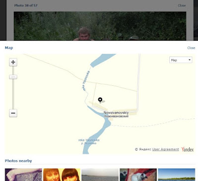
These are Ruslan's geotagged photos relative to the invasion route:

Ruslan's photos had been uploaded in sept/okt 2014. Just after the Russian invasion.
Main route into Ukraine
Let's have a closer look at the smaller 'main road' to and from the Northern Ukrainian camp.
At it's most left/West position, where it enters Dibrivka, it looks like this:

As can be seen an entire new path/road has been made through the field, with sand/debris being pushed to the sides.
This is true for the entire length of this path:


The road ends (or begins) here, where it joins the other tracks going East:

But note this: the main traffic/path goes SOUTHWARDS from here and not EASTWARD (see inset with red path).
South is either the official road to/from Russia, or it connects with the Ukrainian 'aorta', going back West. Why would most traffic drive East just to drive West again after a while?
And also note this: there are four armored vehicles standing there in an obvious way. And it is 22-2-2015. Either these are wrecks, but then why are they not in the LostArmour database? Or they are there because on this date it is STILL an army checkpoint somehow...
Now we must connect the dots...
- We know there were hundreds of vehicles.
- We have seen that there was massive traffic at the official border crossing. Where did they all go? North, East, or West?
- At the crossing just north of this road, most traffic went eastwards.

Conclusion
Another part of the Russian invasions into Ukraine has been clarified more now. Others were the Ilovaisk massacre and the Lugansk Airport attack.
The Ukrainian border camps had not just been destroyed by artillery only. By this invasion the other border camps where cut off and hundreds of Russian vehicles flooded into Ukraine. This lead to the fall and final destruction of these other border camps. And it also was the prelude to and it set the stage for the two other major invasions.
The Golovinka base was the starting point of the operation. From there hundreds of vehicles drove north and set up camp 7 kms from the Ukrainian border. In the previous weeks the Ukrainian camps had already been shelled intensively.
On August 12th the Ukrainian army had established a break-through north of Dmytrivka and had been driving all the way up to Krasnyi Luch, leaving the Marinovka-Dibrivka area vulnerable. See this report.
That must have been the moment the Russians invaded into Ukraine, to take the Ukrainian positions, to chase them and cut them of.
This map was drawn back then:

The Golovinka base was the starting point of the operation. From there hundreds of vehicles drove north and set up camp 7 kms from the Ukrainian border. In the previous weeks the Ukrainian camps had already been shelled intensively.
On August 12th the Ukrainian army had established a break-through north of Dmytrivka and had been driving all the way up to Krasnyi Luch, leaving the Marinovka-Dibrivka area vulnerable. See this report.
That must have been the moment the Russians invaded into Ukraine, to take the Ukrainian positions, to chase them and cut them of.
This map was drawn back then:
Some initial battle groups took several points to cross the border simultaneously and remove all resistance. After securing a bridgehead the larger part of the vehicles took the easier route along the road and headed Northwest to Dmytrivka.
Also see: guided tour through Marinovka area after Russian army paid a visit...
UPDATE
This invasion was prepared and happened while Putin was distracting the world with his Humanitarian White Truck Charade. See this blog.
Interesting detail is that during that time a convoy with more than hundred vehicles was spotted on the road to Novoshakhtinsk.
See this videos:
We had never been able to determine whether this convoy indeed crossed the border at the nearest Dolzhanskyi border crossing. But now that we know of the Marinovka-invasion with hundreds of vehicles involved, the convoy might have been headed there.
According to Google it is exactly on the shortest route from the Rostov army camp to the Marinovka-invasion-camp:

That might have been one day of traveling for a convoy like that. The video says to have been filmed on 10-8-214. It was uploaded on 12-8-2014. That was just before the invasion and thus fits the time schedule perfectly.
The Rostov satellite images indeed show hundreds of vehicles disappear in that timeframe:

Also see: guided tour through Marinovka area after Russian army paid a visit...
UPDATE
This invasion was prepared and happened while Putin was distracting the world with his Humanitarian White Truck Charade. See this blog.
Interesting detail is that during that time a convoy with more than hundred vehicles was spotted on the road to Novoshakhtinsk.
See this videos:
We had never been able to determine whether this convoy indeed crossed the border at the nearest Dolzhanskyi border crossing. But now that we know of the Marinovka-invasion with hundreds of vehicles involved, the convoy might have been headed there.
According to Google it is exactly on the shortest route from the Rostov army camp to the Marinovka-invasion-camp:
That might have been one day of traveling for a convoy like that. The video says to have been filmed on 10-8-214. It was uploaded on 12-8-2014. That was just before the invasion and thus fits the time schedule perfectly.
The Rostov satellite images indeed show hundreds of vehicles disappear in that timeframe:

And this is interesting... North of Dmytrivka BTR-82 had been spotted (among other sophisticated Russian equipment by the way):

These BTR-82s had never seen before in Ukraine at that date.
It turns out the Novoshakhtinsk-convoy had BTR-82s among them too:

More on the differences between BTR-80 and BTR-82, see this article.


